FEMA Post-Disaster Recovery & Substantial Damage Estimates (SDEs)
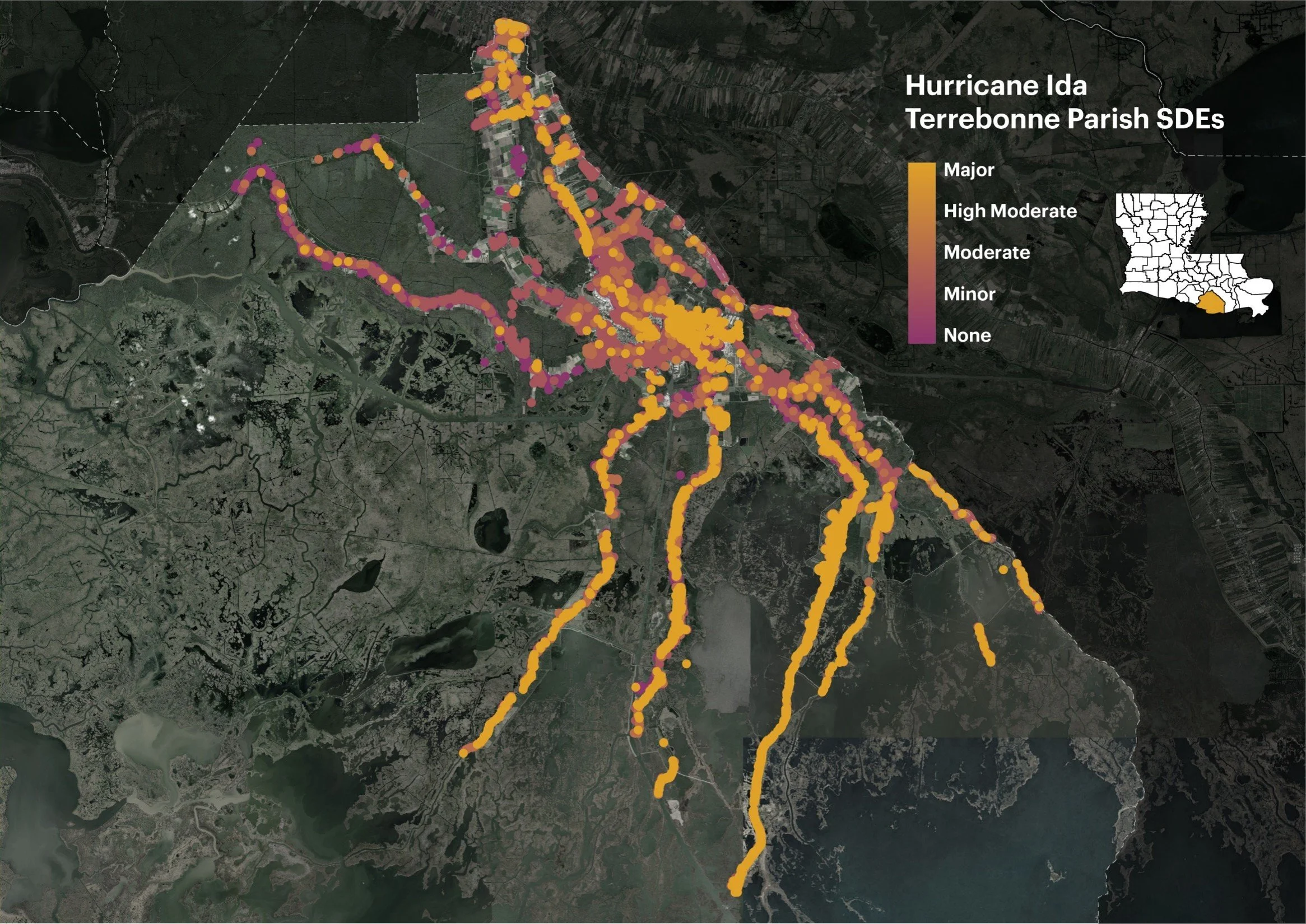
Terrebonne Parish Consolidated Government, La
Desire Line completed more than 35,000 FEMA Substantial Damage Estimates (SDEs) in close coordination with the Terrebonne Parish Planning Department, meeting and exceeding minimum FEMA National Flood Insurance Program (NFIP) requirements following Hurricane Ida (2021).
In addition to SDE delivery, Desire Line documented recommended recovery programs, identified unmet community needs, scanned all elevation certificates on file and inventoried them in a searchable index to support future FEMA compliance and monitoring, and analyzed potential federal, state, and grant funding sources to support long-term recovery and resilience efforts. The Desire Line team utilized ArcGIS Survey123 alongside proprietary, in-house software to ensure the rapid, accurate completion of this work. This methodology was subsequently highlighted by FEMA during a 2022 American Planning Association (APA) workshop as a best-in-class model for conducting large-scale, post-disaster SDE recovery efforts.
Denham Springs, La
Don’t wait until a disaster happens, get your community situated now for a quick recovery response via FEMA Substantial Damage Estimates
Since 2023, the City of Denham Springs has retained Desire Line (in partnership with Meyer Engineers Ltd. and JAS Unmanned Aerial Services) in a standby contract to provide substantial damage determinations, strategic planning for FEMA Substantial Damage compliance and monitoring, public outreach, administrative support, and long-term recovery logistics. Because being proactive means quicker recovery for your community.
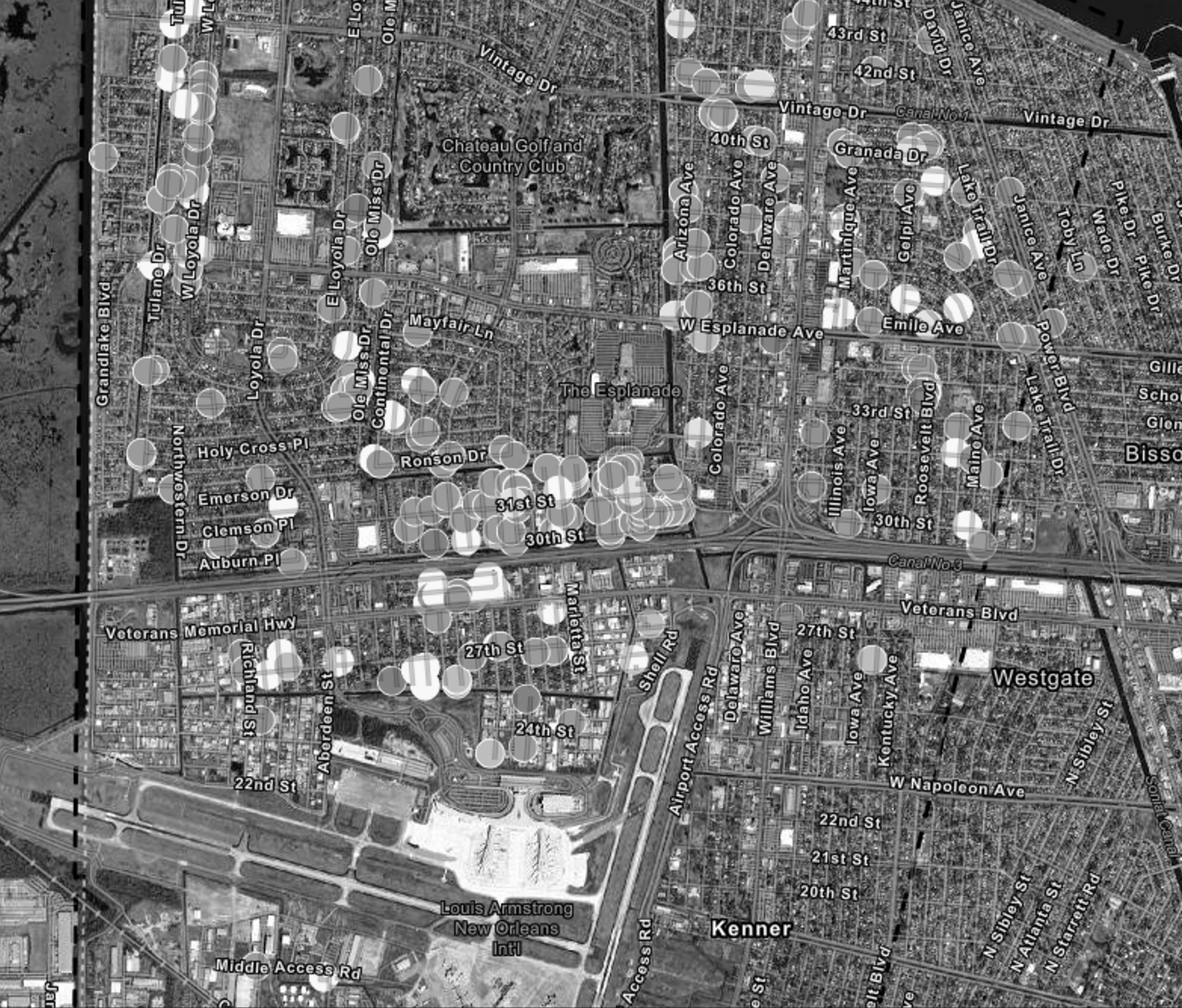
Kenner, La
Desire Line provided rapid, FEMA-compliant post-disaster re-inspection of damage assessment, and recovery planning support following Hurricane Ida.
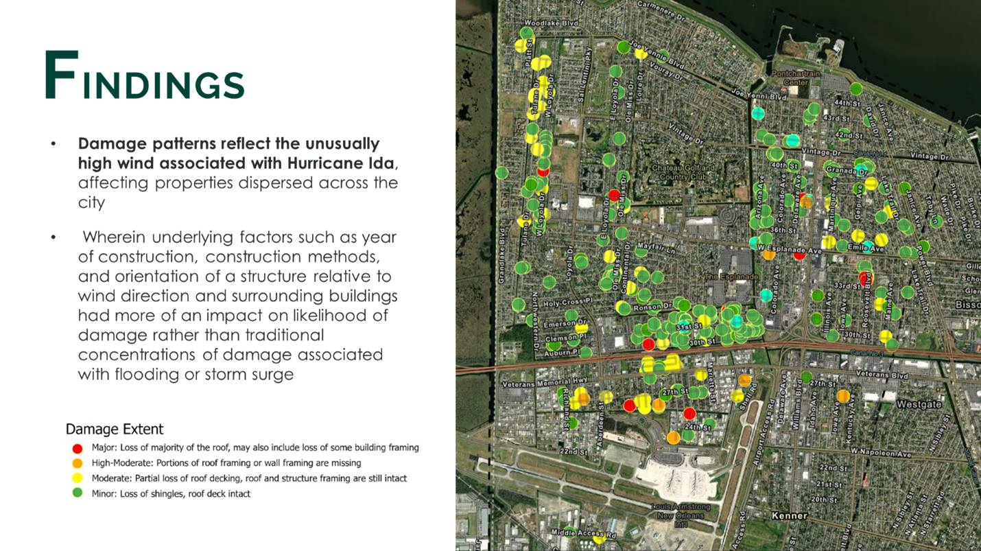
In response to Hurricane Ida (2021), Desire Line completed a comprehensive review and re-inspection of FEMA substantial damage determinations in coordination with the City of Kenner Inspection and Code Enforcement Department, in fulfillment of minimum FEMA NFIP requirements, as well as documented recommended recovery programs, unmet needs, and potential sources of grant funding to support long-term recovery efforts. Desire Line completed field work for this project within one month including production of a fully interactive GIS map showing damage information on each property inspected, full damage assessment reports for each property, a report showing total damage analysis, an unmet needs assessment for the City, and coordination with FEMA to ensure that all data was transferred to federal and state agencies in accordance with NFIP and state protocols.