
Our Services

Urban & Regional Planning, Floodplain Management
Elevating the invisible lines that shape our lives
Master and/or Comprehensive plans including action plans and implementation matrices to support immediate action, including area studies, master site plans and developments, future land use planning and maps, housing studies, multi-modal assessments, community revitalization plans, climate adaptation strategies, safe streets for all plans, and long-term resilience strategies
Local economic development initiatives including development and implementation support for special financing districts, commercial overlays and use studies, targeted market studies, and business incentive programs, and private fundraising support (oftentimes aligned with grant application supportive services)
Development of resilient and adaptive zoning overlays to require elevated housing and resilient building practices, land use studies to reduce densities in flood prone areas
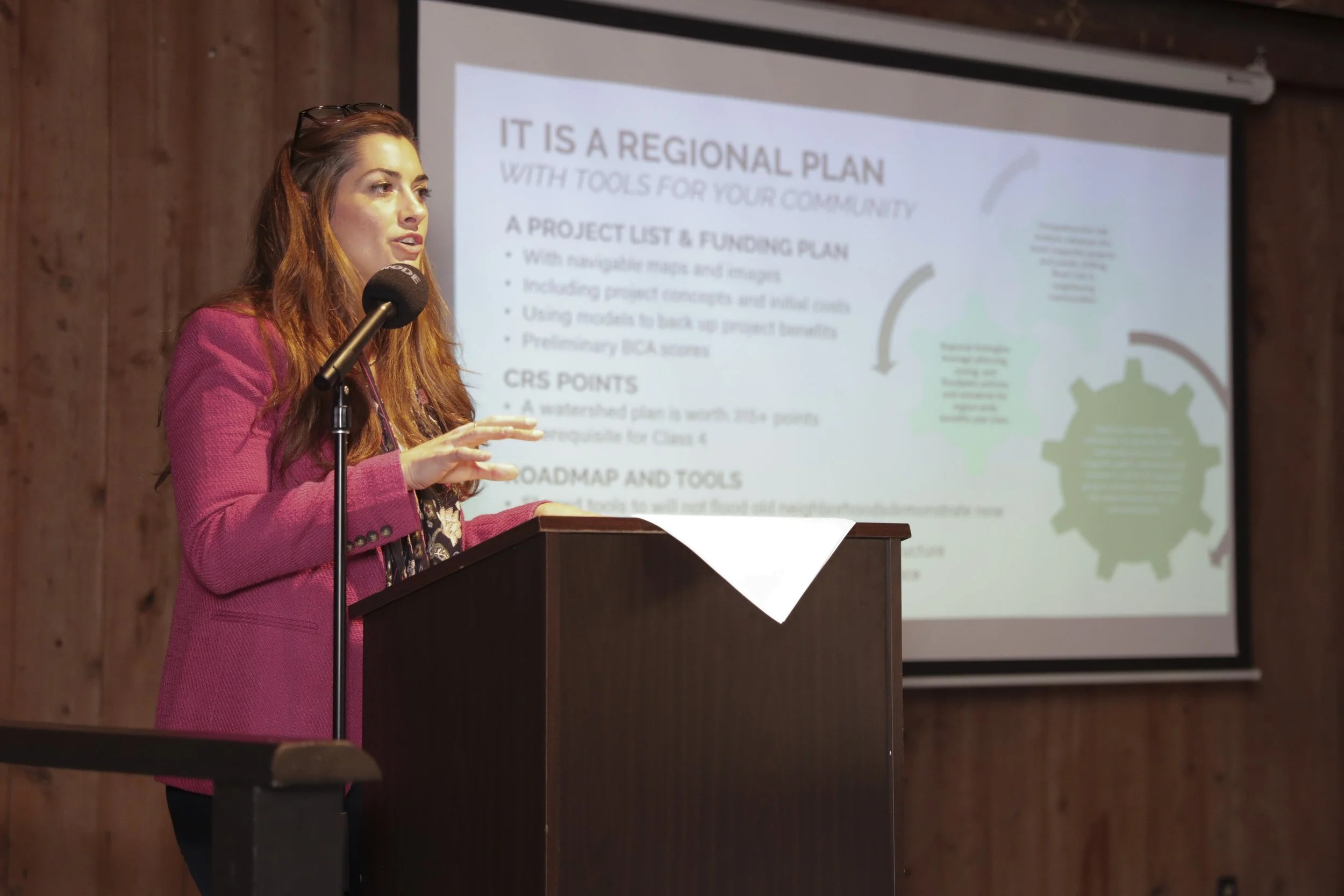
Floodplain management support and training, including open-source (free) CRS reporting tools developed by Desire Line, CRS recertification and cycle visit assistance, CAV visit support, Repetitive Loss Area Analyses, Flood Damage Prevention Studies, Resilient Housing Plans, model floodplain ordinance drafting and updates, and floodplain and repetitive loss mapping guidance
Stormwater management support including stormwater management ordinance drafting and updates, regional watershed master plans and modeling, and MS4 program assistance
Stormwater control measures and fee studies, landscaping regulations, green infrastructure, low-impact development alternatives, and innovative floodplain management practices and reporting support
Local code drafting, including graphics and design standards, landscaping, multifamily housing, missing middle housing, short-term rentals, use standards, content neutral sign codes, land use studies, staff reports, planning and zoning permit review, public hearing facilitation
Development and updates of future land use maps and official zoning maps
Community and stakeholder outreach and engagement
Development of PPI materials and PPI implementation
Coastal Use Permit application and management
Aerial drone imagery to support understanding of current and desired land use patterns and their context
Grant & Program Management
Making every dollar count
Grant strategy development and recommendations in alignment with identified local needs
Scoping and preparation of grant applications including budget, statement of need, maps and graphics, and letters of support
Grant program development and management including rule and policy-making, program policy and procedure development, program launch, fund distribution, procurement, project evaluation, selection and award, compliance, monitoring, and closeout

Disaster Response & Recovery Support Services
A team built from public service focused on protecting the community’s interest when it matters most
Disaster preparedness planning, including risk & vulnerability assessments; FEMA guided emergency operation plans, command structures and responsibilities; communication and coordination protocols, essential partnerships, training; and resource management and planning
Federal program navigation support, including FEMA's Public Assistance (PA) (infrastructure), Hazard Mitigation Grant Program (HMGP) (future risk reduction), and Community Development Block Grants (CDBG-DR) (long-term community needs)
Pre- and post-disaster EOC support, including emergency operations standard operating procedures (SOPs) and communication plans, as well as in person emergency operation centers assistance through Incident Action Plan formulation, asset tracking, procurement assistance, cost tracking, WebEOC expertise, and overall administrative reinforcement
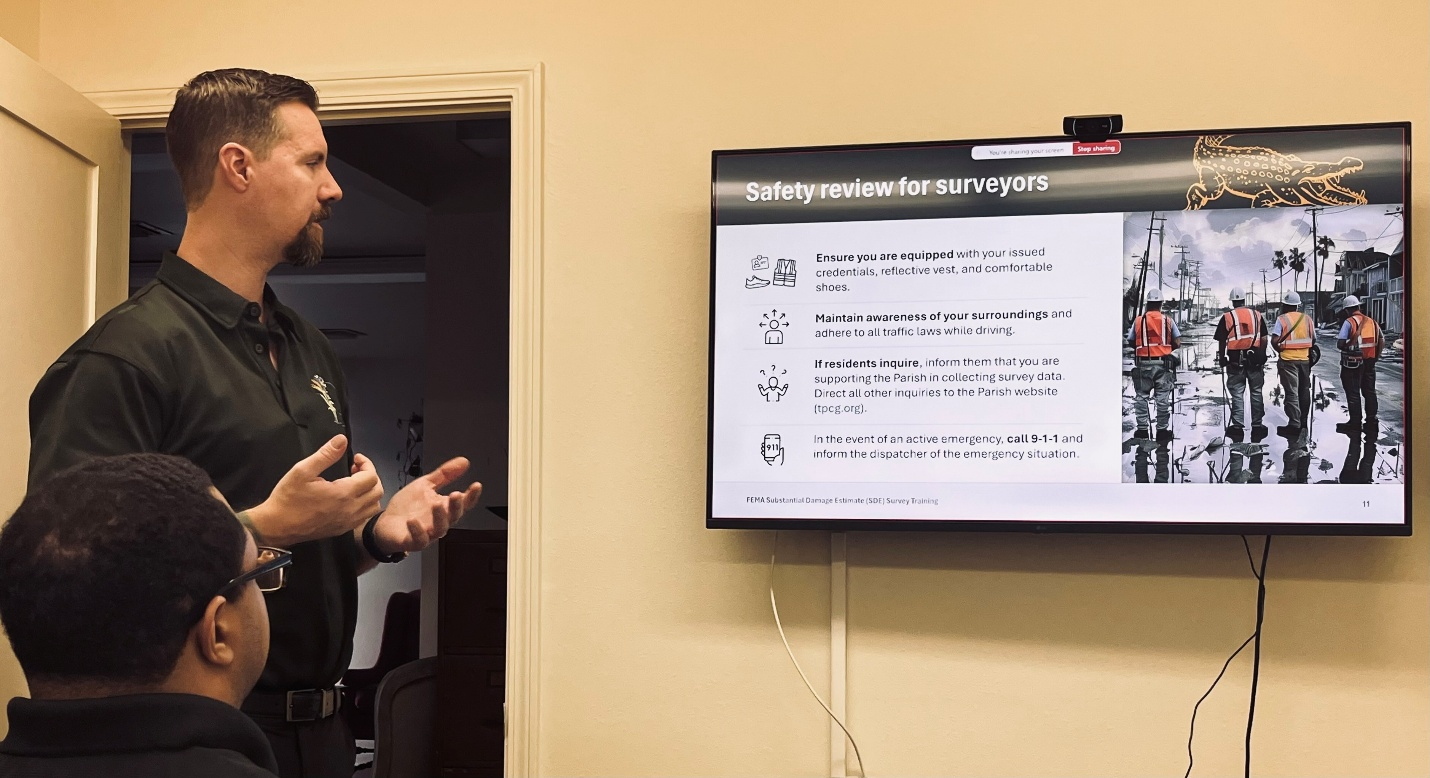
Post-disaster FEMA National Flood Insurance Program (NFIP) compliant Substantial Damage Determinations and Estimates, including initial damage surveys; field data collection and coordination; GIS services; local dataset review and resolution; housing market valuation analysis; dataset and photograph consolidation & bulk analysis; and drone services for validation
FEMA Substantial Damage Letter Distribution, including full end-to-end support for required FEMA SDEs including field data collection, recommended determinations, and preparation of letters to owners of all impacted structures
Cumulative damage calculations across multiple events and areas
Post-disaster staff augmentation and training for long-term damage assessment reporting and permit review and issuance, floodplain management, code enforcement, planning and zoning, elevation certificate records retrieval and digitization
Ongoing FEMA coordination and reporting, including direct assistance with producing and submitting required documentation
Community engagement and recovery program assistance, including assistance in organizing community outreach initiatives to aid affected populations, including supporting housing assistance and economic revitalization programs

Government Administrative Support
We are in this together
Historic Preservation services including; completing historic surveys, preparing National Register of Historic Places applications, developing preservation grants, preservation plans for historic districts, downtown revitalization plans, and small area and corridor plans for municipalities and parishes
Issue-specific direct support and/or training series to enhance local capacity building for new administration, planning commissioner, police jury or council member and staff, re: grants development, code enforcement, planning, floodplain management
Project and capital improvement planning, procurement and procedures development, implementation support and assistance
GIS map development, data maintenance, file digitization, and data cleanup in support of improved data-based decision-making
Code Enforcement Administrative support, re: case review, attendance at adjudication hearings, supporting field staff determinations, updating relevant ordinances for enhanced efficiency
Local floodplain management assistance, mentorships, and trainings
Document management and records retention policy and implementation support
Outreach & Engagement
Clear and predictable processes maintain trust and build consensus
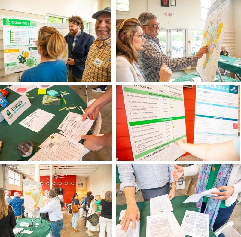
Development of well-balanced, trust-based community Outreach & Engagement processes
Outreach materials to share information, build knowledge, and combat misinformation including through project websites, email campaigns and social media, presentations, tabling at community events, fact sheets, graphics, yard signs, and more
Engagement tools to facilitate two-way communication and collaboration with community members, stakeholders and elected officials through an iterative, shared process including effective and inclusive community workshops, focus groups, project steering committees, stakeholder interviews, open house Q&A sessions, teen engagement, community surveys, interactive maps, Facebook polls and consensus building with diverse interest groups at all project stages
Outreach and Engagement services are part of all Desire Line projects or can be a standalone service to support client and community needs
Strategic Implementation Services
Advancing smarter solutions unique to our time
Strategic, adaptation-specific research, analysis, and implementation leadership and support
Business development and public service-oriented web-based automation services, online mapping, and focused integrations to work smarter, save time, and better utilize limited resources
Advancement of co-developed solutions through thoughtful collaboration, partnership alignment, and task-specific, multi-year plans shaped by stakeholders where all partners have clear actions and directives

Evelyn Cade Campo, CFM, Deputy CEO - Desire Line